10: Visibility Mode
![]() Visibility mode uses the app's terrain data to
compute what should be visible from a particular viewpoint. Simply place the crosshairs over the
viewpoint and touch the Visibility button; the app will paint over the map with the hidden areas
in red:
Visibility mode uses the app's terrain data to
compute what should be visible from a particular viewpoint. Simply place the crosshairs over the
viewpoint and touch the Visibility button; the app will paint over the map with the hidden areas
in red:
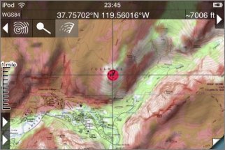
This is of course limited by the resolution of the data. In particular, note that to avoid errors in the data near the viewpoint (which would have a more substantial impact on the results than errors further away), the app computes the view from 30m about ground level and ignores all obstacles within about 400m of the viewpoint.