8: Distance and Bearing
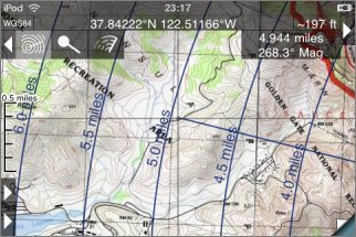
![]() Distance and bearing mode is available when
the co-ordinate display is shown. Place the crosshairs over a point of interest and touch the button with the
concentric circles icon:
Distance and bearing mode is available when
the co-ordinate display is shown. Place the crosshairs over a point of interest and touch the button with the
concentric circles icon:
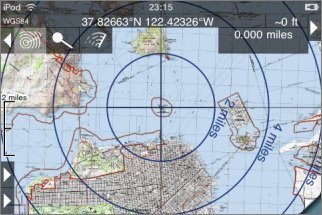
Concentric distance rings are shown, and as you move around the map the distance and bearing from the selected point to the crosshairs is updated:
To turn off the feature, touch the button again.
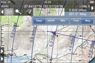
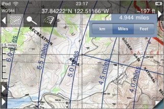
Available Units
The units for the distance and bearing can be changed by touching the appropriate display for about half a second. For the distance display the available units are km, miles and feet:
Bearings can be shown in degrees, as compass points (i.e. N, S, E, W) and mils. (There are 6400 mils in 360 degrees.) The bearing can be shown either relative to true North or relative to magnetic North. The magnetic deviation is predicted using the World Magnetic Model; it should be accurate to better than half a degree.