5: Searching
The Search Screen
![]() The search screen is accessible
from both the topo map screen and the index map screen by touching the
magnifier icon.
The search screen is accessible
from both the topo map screen and the index map screen by touching the
magnifier icon.
As you type the list of matching place names is continuously updated. If there are thousands of matching names it may take a few seconds for the list to appear. The app doesn't show a listing if more than 50,000 places match.
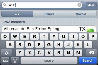
Three buttons allow you to change how the results are ordered. They can be either alphabetical, grouped according to feature type, or by distance from the center of the current screen.
The Search Results
Each search result row shows the name of the feature, the state or province, a symbol indicating the feature type, and location information.
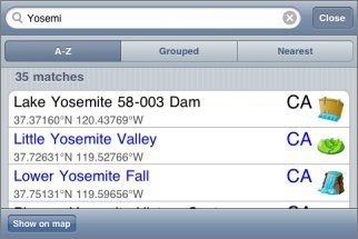
If the feature is on a topo that is already installed, the name and state are shown in blue.
The format of the location information can be changed by touching it for about half a second. A set of buttons will appear where you can change between showing co-ordinates and distance+bearing:
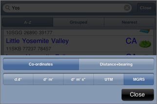
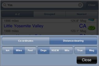
The available formats are the same as for the main co-ordinate and distance+bearing displays. Distance and bearing are relative to the current center of the screen.
Touching a search result will take you to that feature on the map. If the appropriate topo is already installed it will be shown, otherwise the index map will be shown.
Waypoints
Waypoints are included in the search results. Normal waypoints are shown with a yellow/gold background, and file waypoints are shown with a Gray/silver background.
Search Results on Maps
You can show the current search results on the map, if there are no more than 10,000 of them. Touch the "Show on map" button at the bottom left of the search screen and the positions of the search results will be shown on both the index and the topo maps with small purple spots:
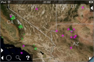
To clear these spots, return to the search screen and clear the search box.
Rivers and related features
For rivers, the app always shows the downstream end of the feature. For example, searching for a small creek will show the point where it joins a larger river and changes its name.
The same applies to other features that have upstream and downstream ends, including valleys and lakes.
What's Included
The app contains a database of about 1.5 million feature names. These come from the USGS and Canadian government sources and have been filtered to remove some of the less useful categories. Also included are the names of the maps themselves.
Feedback about missing features or groups of features that could be removed to save space would be appreciated.